



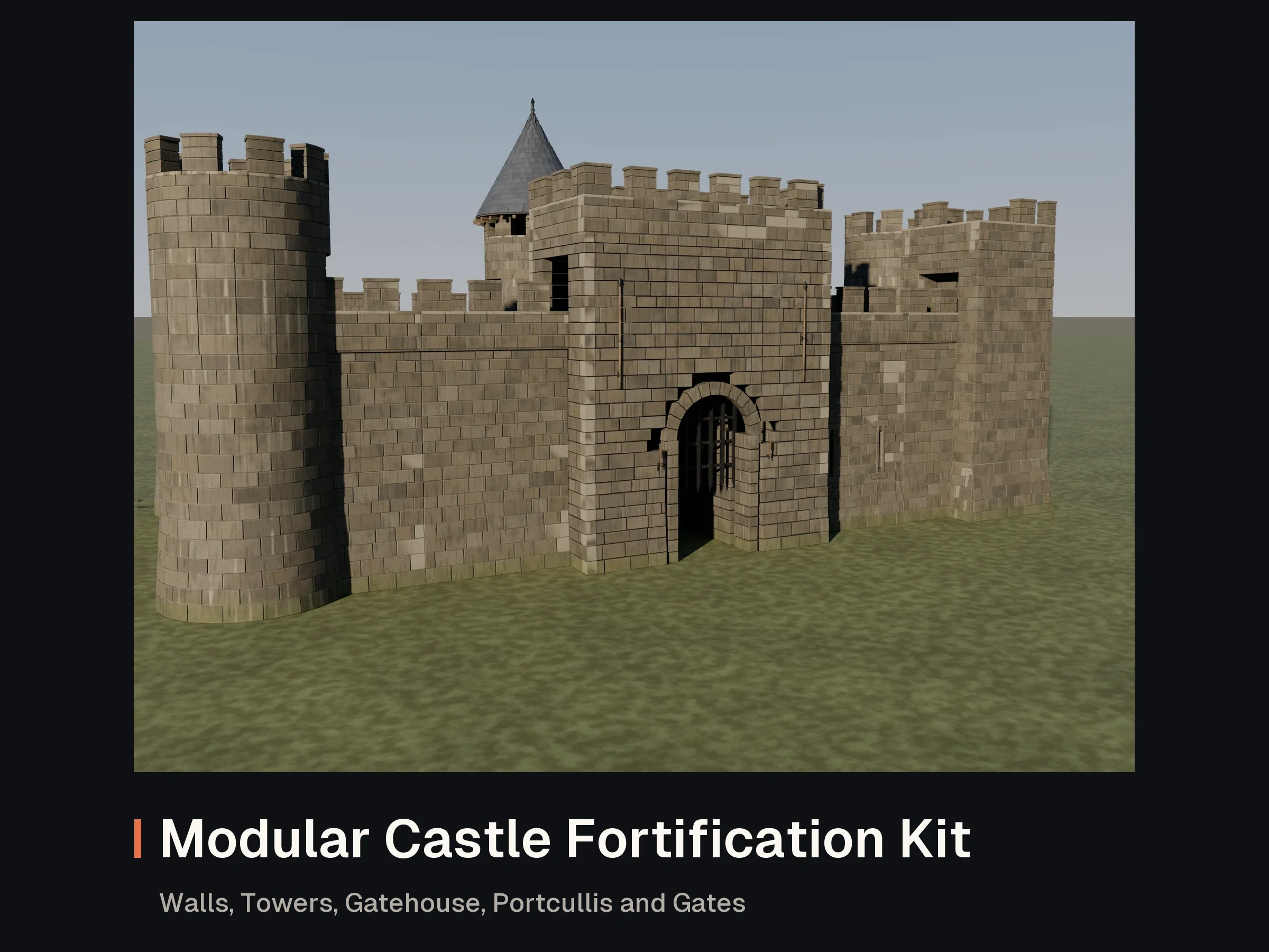

Files validated
- Interactive 3D preview
Modular Castle Fortification Kit: Walls, Towers, Gatehouse, Portcullis and Gates
FBX · GLB · PNG · BLEND
- 1
300 creditsNo reviews yet
A 36-piece hex terrain kit for strategy, tabletop, city-builder and tactics games: terrain bases, coasts, dirt roads, rivers, a stone bridge, village and castle buildings, a windmill with moving sails, a mine, a lumber camp, a harbour dock and props, all on a pointy-top hex grid 2 m across flats. Chunky diorama-board tiles with bevelled rims and soil strata on the sides, faceted low-poly shapes, baked PBR detail, three LODs and convex collision on every piece. Every edge of every tile was checked numerically (see Good to know for the result).
UCX_ naming for Unreal): a hex prism per tile plus hulls for trees, mounds, the peak, the bridge deck, walls, roofs, turrets, stalls and chimneysWorks in Unity, Unreal Engine and Godot (and anything that reads FBX or GLB). The README has the axial grid formula, placement, import and LOD notes for each engine.
CONVENTIONS
  Units: metres, board scale (a cottage is about 1.1 m tall on a 2 m tile: this is a diorama-board kit, not
    character scale). Z-up in .blend; FBX/GLB exported Y-up (engine default).
  Hex: pointy-top, 2.0 m across flats (inradius 1.0 m, circumradius 1.1547 m). Corners at 30, 90, ... 330 degrees.
  Edges: edge k (k = 0..5) has its outward normal at 60k degrees and its midpoint at (cos 60k, sin 60k) metres:
    edge 0 = +X (east), 1 = north-east, 2 = north-west, 3 = -X (west), 4 = south-west, 5 = south-east.
  Layout (axial q, r): x = 2.0 q + 1.0 r, y = 1.7321 r. Neighbours: edge 0 (q+1, r), 1 (q, r+1), 2 (q-1, r+1),
    3 (q-1, r), 4 (q, r-1), 5 (q+1, r-1). Rotate tiles in 60 degree steps about Z: a rotation of 60 n degrees
    moves edge k to edge k + n.
  Pivot: every tile pivots at its hex centre at the walkable land level z = 0 (top surface). The body goes down
    to z = -0.5 with the soil strata on its sides (the board edge). Rims have a 12 mm bevel.
  Rim rule: land and road edges sit at z = 0 along the whole edge; water edges carry the water surface at
    z = -0.12 (seabed -0.35) right into both corners; river edges carry the river cross-section. Hills, the
    mountain and dunes rise only inside the rim.
  Corner rule (coast_1/2/3, river_mouth): a land edge that shares a corner with a water edge dips to -0.12 at
    that corner and climbs to 0 over its first 20 cm, with the same profile on every such edge, so two coast
    tiles and a water tile meet at a corner with no step. Only a plain land tile placed against such an edge
    (two beaches facing each other with no water tile between them) shows a 12 cm step at that corner. Buildings sit on a flat tile (grass, meadow, coast land) with their pivot on the hex
    centre at z = 0.
  Roads: 0.6 m wide dirt band, flat at z = 0 (ruts are in the normal map), entering and leaving at edge
    midpoints perpendicular to the edge: straight (edges 3-0), bend 120 degrees (0-2), sharp 60 degrees (0-1),
    three-way junction (0, 2, 4), end with a turning circle (edge 3).
  Rivers: 0.7 m between bank tops (z = 0), bed at z = -0.22, opaque stylised water surface 0.56 m wide at
    z = -0.12: straight (3-0), bend 120 degrees (0-2), source (spring pool, leaves at 0), mouth (enters at 3,
    sea on edges 0 and 1). Bridge: river 3-0 under a road 1-4 (the road crosses at 60 degrees, so the arch is a skew arch
    running along the river; the full river channel and water surface pass under it unbroken).
  Coasts: coast_1 water on edge 0, coast_2 on edges 0 and 1, coast_3 on edges 5, 0 and 1; beach slopes from
    the land rim to the water; the water tile has its surface at -0.12 on all six edges. Water surfaces are
    opaque, baked (depth tint, foam ring); swap in your own water shader if you want transparency.
  Buildings and props: pivot at the footprint centre on z = 0 (place on the hex centre); each has a small
    base patch. mine_entrance opens to +X (put hills or the mountain behind it, -X). harbour_dock runs +X and
    overhangs edge 0 by 0.46 m: place it on a coast tile rotated so edge 0 is water. windmill_sails is a
    separate piece: pivot at the hub centre, place at windmill + (0, -0.5, 0.98) and rotate about its local Y.
    fence_segment runs along edge 0 (x = 0.93); rotate 60 n degrees for the other edges.
  LODs: LOD0, LOD1, LOD2 (about 39% and 21% of LOD0 across the kit); LOD1 keeps the rims and
    silhouettes exact (flat tops use only a few triangles).
  Collision: convex hulls (UCX_<piece>_NN inside <piece>.fbx, plus <piece>_collision.glb): one hex prism per
    flat tile (top at z = 0; river and beach dips are not cut from it; the water tile's prism tops at -0.12),
    plus one hull per tree, rock, mound, bridge deck, wall block, roof, turret, stall or chimney.
  Textures per piece (PNG): basecolor 1024 (sRGB), normal 1024 (OpenGL, +Y; flip green for Unreal), roughness
    and metallic 512 (greyscale), unity_metallic_smoothness 512 (grey = metallic, alpha = smoothness).
| Piece | Size (m) | Triangles LOD0 / LOD1 / LOD2 | Collision | Edges 0..5 | Pivot / notes |
|---|---|---|---|---|---|
| Grass | 2.00 x 2.31 x 0.51 | 1,140 / 64 / 20 | 20 tris | l l l l l l | hex centre at the walkable level z = 0 (top surface); the body goes down to z = -0.5 |
| Grass meadow (flowers, tufts) | 2.00 x 2.31 x 0.56 | 1,356 / 278 / 119 | 20 tris | l l l l l l | hex centre at the walkable level z = 0 (top surface); the body goes down to z = -0.5 |
| Pine forest | 2.00 x 2.31 x 1.53 | 2,028 / 960 / 748 | 398 (8 hulls) tris | l l l l l l | hex centre at the walkable level z = 0 (top surface); the body goes down to z = -0.5 |
| Broadleaf forest | 2.00 x 2.31 x 1.39 | 1,704 / 548 / 268 | 290 (7 hulls) tris | l l l l l l | hex centre at the walkable level z = 0 (top surface); the body goes down to z = -0.5 |
| Grassy hills with rock outcrops | 2.00 x 2.31 x 0.92 | 1,620 / 938 / 506 | 484 (7 hulls) tris | l l l l l l | hex centre at the walkable level z = 0 (top surface); the body goes down to z = -0.5 |
| Mountain peak with snow cap (1.6 m) | 2.00 x 2.31 x 2.10 | 1,670 / 1,018 / 536 | 132 (2 hulls) tris | l l l l l l | hex centre at the walkable level z = 0 (top surface); the body goes down to z = -0.5 |
| Desert dunes | 2.00 x 2.31 x 0.66 | 1,380 / 538 / 166 | 250 (4 hulls) tris | l l l l l l | hex centre at the walkable level z = 0 (top surface); the body goes down to z = -0.5 |
| Deep water | 2.00 x 2.31 x 0.38 | 1,740 / 225 / 134 | 20 tris | w w w w w w | hex centre at the land level z = 0; water surface at z = -0.12, seabed at -0.35, body to -0.5 |
| Coast, one water edge (edge 0) | 2.00 x 2.31 x 0.51 | 1,365 / 272 / 125 | 20 tris | w l l l l l | hex centre at the walkable level z = 0 (top surface); the body goes down to z = -0.5 |
| Coast, two water edges (0, 1) | 2.00 x 2.31 x 0.51 | 1,530 / 364 / 157 | 20 tris | w w l l l l | hex centre at the walkable level z = 0 (top surface); the body goes down to z = -0.5 |
| Coast, three water edges (5, 0, 1) | 2.00 x 2.31 x 0.51 | 1,698 / 439 / 217 | 20 tris | w w l l l w | hex centre at the walkable level z = 0 (top surface); the body goes down to z = -0.5 |
| Road, straight (edges 3 to 0) | 2.00 x 2.31 x 0.53 | 1,360 / 184 / 144 | 20 tris | r l l r l l | hex centre at the walkable level z = 0 (top surface); the body goes down to z = -0.5 |
| Road, bend 120 degrees (edges 0 to 2) | 2.00 x 2.31 x 0.53 | 1,360 / 164 / 126 | 20 tris | r l r l l l | hex centre at the walkable level z = 0 (top surface); the body goes down to z = -0.5 |
| Road, sharp bend 60 degrees (edges 0 to 1) | 2.00 x 2.31 x 0.53 | 1,340 / 148 / 92 | 20 tris | r r l l l l | hex centre at the walkable level z = 0 (top surface); the body goes down to z = -0.5 |
| Road, three-way junction (edges 0, 2, 4) | 2.00 x 2.31 x 0.53 | 1,444 / 252 / 180 | 20 tris | r l r l r l | hex centre at the walkable level z = 0 (top surface); the body goes down to z = -0.5 |
| Road end with turning circle (edge 3) | 2.00 x 2.31 x 0.53 | 1,350 / 170 / 130 | 20 tris | l l l r l l | hex centre at the walkable level z = 0 (top surface); the body goes down to z = -0.5 |
| River, straight (edges 3 to 0) | 2.00 x 2.31 x 0.51 | 1,562 / 172 / 96 | 20 tris | v l l v l l | hex centre at the walkable level z = 0 (top surface); the body goes down to z = -0.5 |
| River, bend 120 degrees (edges 0 to 2) | 2.00 x 2.31 x 0.51 | 1,732 / 246 / 90 | 20 tris | v l v l l l | hex centre at the walkable level z = 0 (top surface); the body goes down to z = -0.5 |
| River source: spring from a rock (edge 0) | 2.00 x 2.31 x 0.56 | 2,124 / 655 / 340 | 316 (5 hulls) tris | v l l l l l | hex centre at the walkable level z = 0 (top surface); the body goes down to z = -0.5 |
| River mouth: river (edge 3) meets the sea (edges 0, 1) | 2.00 x 2.31 x 0.51 | 2,263 / 551 / 278 | 20 tris | w w l v l l | hex centre at the walkable level z = 0 (top surface); the body goes down to z = -0.5 |
| Stone arch bridge: road (edges 1, 4) over river (edges 3, 0) | 2.00 x 2.31 x 0.77 | 2,030 / 640 / 424 | 68 (2 hulls) tris | v r l v r l | hex centre at the walkable level z = 0 (top surface); the body goes down to z = -0.5 |
| Cottage (thatch) | 1.39 x 1.10 x 1.13 | 1,492 / 894 / 446 | 32 (3 hulls) tris | - | footprint centre on the hex centre at z = 0 |
| House pair, terrace (clay tiles) | 1.75 x 1.06 x 1.17 | 2,140 / 1,284 / 642 | 44 (4 hulls) tris | - | footprint centre on the hex centre at z = 0 |
| Farm: barn and fenced field | 1.83 x 1.57 x 0.79 | 2,362 / 1,416 / 708 | 32 (3 hulls) tris | - | hex centre at z = 0 (barn west, field east) |
| Windmill tower (sails separate) | 1.33 x 1.35 x 1.16 | 530 / 446 / 222 | 42 (2 hulls) tris | - | tower centre on the hex centre at z = 0; sails hub at (0, -0.5, 0.98), axis -Y |
| Windmill sails (moving, pivot on the hub axis) | 1.26 x 0.14 x 1.26 | 1,136 / 680 / 340 | 48 (4 hulls) tris | - | hub centre; rotate about the local Y axis; place at windmill + (0, -0.5, 0.98) |
| Timber watchtower | 0.92 x 0.95 x 1.48 | 1,244 / 746 / 372 | 30 (3 hulls) tris | - | tower centre on the hex centre at z = 0; ladder on the -Y side |
| Stone castle keep | 1.67 x 1.68 x 1.54 | 1,732 / 1,037 / 516 | 144 (6 hulls) tris | - | keep centre on the hex centre at z = 0; gate on the -Y side |
| Market stalls with cloth awnings | 1.76 x 1.70 x 0.58 | 1,936 / 1,160 / 580 | 36 (3 hulls) tris | - | market centre on the hex centre at z = 0 |
| Mine entrance (timber-framed adit) | 1.73 x 1.35 x 0.56 | 1,202 / 720 / 358 | 112 (5 hulls) tris | - | hex centre at z = 0; adit opens to +X (pair with hills or mountain behind it) |
| Lumber camp: log pile, saw horse, stump | 1.76 x 1.46 x 0.53 | 1,680 / 1,281 / 910 | 36 (3 hulls) tris | - | camp centre on the hex centre at z = 0 |
| Harbour dock (pier overhangs edge 0) | 1.61 x 0.52 x 0.78 | 1,780 / 1,068 / 534 | 24 (2 hulls) tris | - | hex centre at z = 0; the pier runs +X and overhangs the edge-0 water by 0.46 m (place on a coast tile whose edge 0 is water) |
| Pine tree | 0.58 x 0.57 x 0.99 | 138 / 82 / 39 | 54 tris | - | trunk base on the hex centre at z = 0 |
| Broadleaf tree | 0.61 x 0.58 x 0.84 | 94 / 55 / 27 | 44 tris | - | trunk base on the hex centre at z = 0 |
| Rock cluster | 0.71 x 0.64 x 0.31 | 400 / 326 / 244 | 386 (5 hulls) tris | - | cluster centre on the hex centre at z = 0 |
| Fence segment (along edge 0) | 0.04 x 1.10 x 0.24 | 308 / 184 / 92 | 12 tris | - | hex centre at z = 0; the fence runs along edge 0 at x = 0.93 (rotate in 60 degree steps for the other edges) |
File check: every shipped FBX and GLB file was re-imported (253 of 253 loaded with their meshes), LODs decrease on every piece, every hull is convex; edge check: every one of the 4813 connecting edge pairs (land, road, river and water, including the coast and river-mouth corners) sits within 2 mm of its partner at LOD0; the worst measured gap is 0.8 mm.
Latest version 1.1.0, released .
1.1.0
Documentation tidy-up: README with the product name, version, licence and support details, and current product names. No changes to the models or files.
1.0.1
File tidy-up: cleaner file metadata and notes; no changes to the models.
1.0.0
FBX · GLB · PNG · BLEND
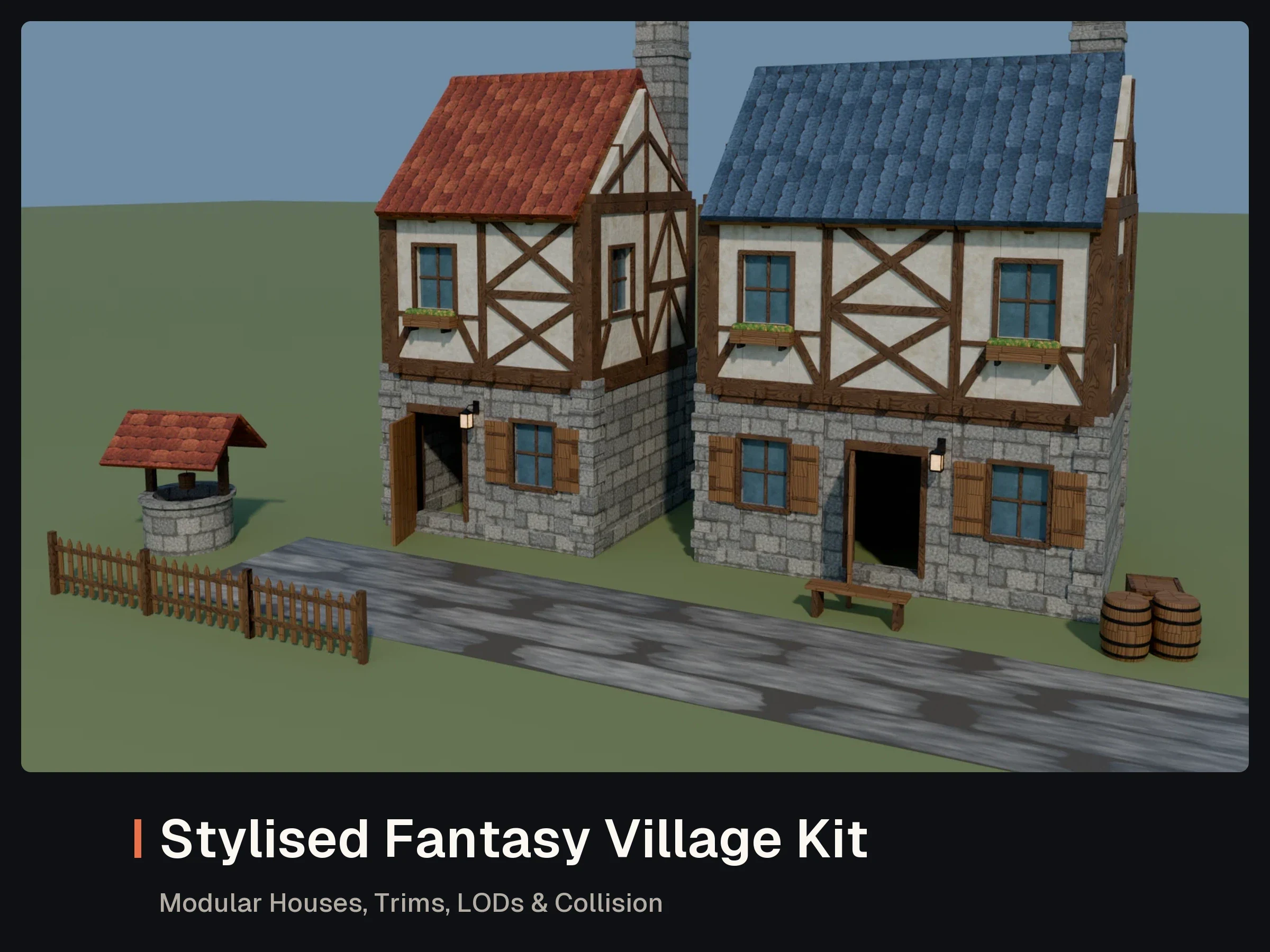
GLB · FBX · OBJ · BLEND · PNG
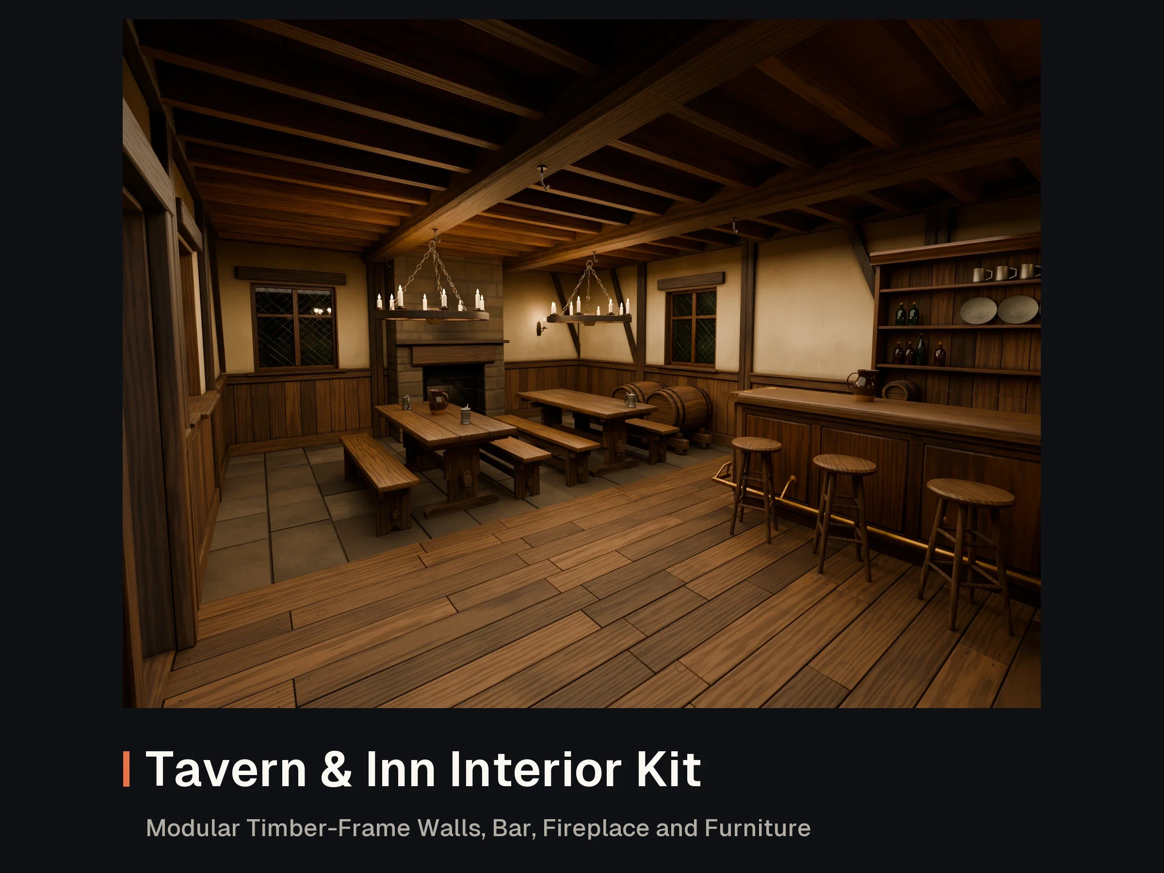
FBX · GLB · PNG · BLEND
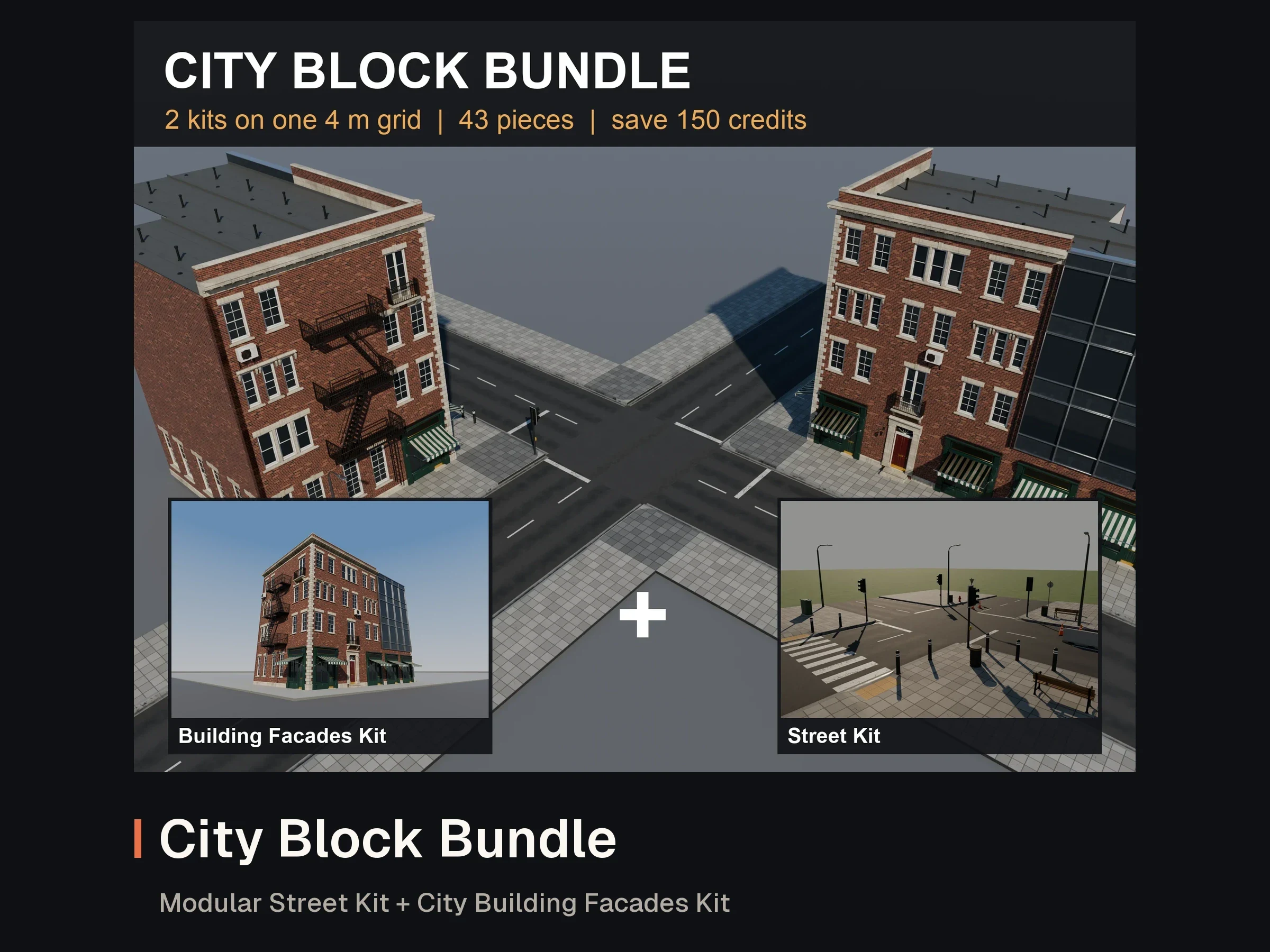
FBX · GLB · PNG · BLEND
Own this asset? Sign in to review it.
No reviews yet. Owners can share how the asset worked for them.
Sign in to ask the creator a question.
No questions yet. Ask about formats, compatibility or licensing.